Providing Environmental Services Since 1967
Biological Services
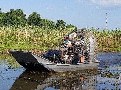
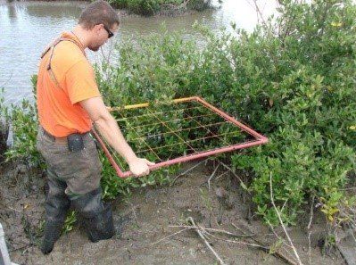
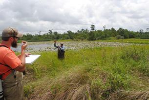

BIOLOGICAL ASSESSMENTS
Coastal Environments, Inc. (CEI) assists clients in the governmental, business, industry and private sectors by providing biological services required for site and regional planning, design, implementation and monitoring for development, as well as natural resources conservation, restoration and sustainability. The firm, founded and headquartered in Baton Rouge in 1967, operates out of four branch offices and conducts biological investigations throughout the Northern Gulf Coastal Plain and Mississippi River Valley Region in both nearshore marine, coastal estuarine and freshwater wetlands and upland environments.
The firm’s biologists have degrees in biological and ecological sciences and wildlife and fisheries management and remain current in their fields through specialized training, workshops and seminars. They conduct investigations and produce professional quality reports in compliance with the most current regulatory guidelines and protocols. CEI’s biologists maintain excellent working relationships with clients and regulatory agencies which result in repeat business and expeditious project performance. Routine biological services include:
- Wetland Delineations and Jurisdictional Determination Requests
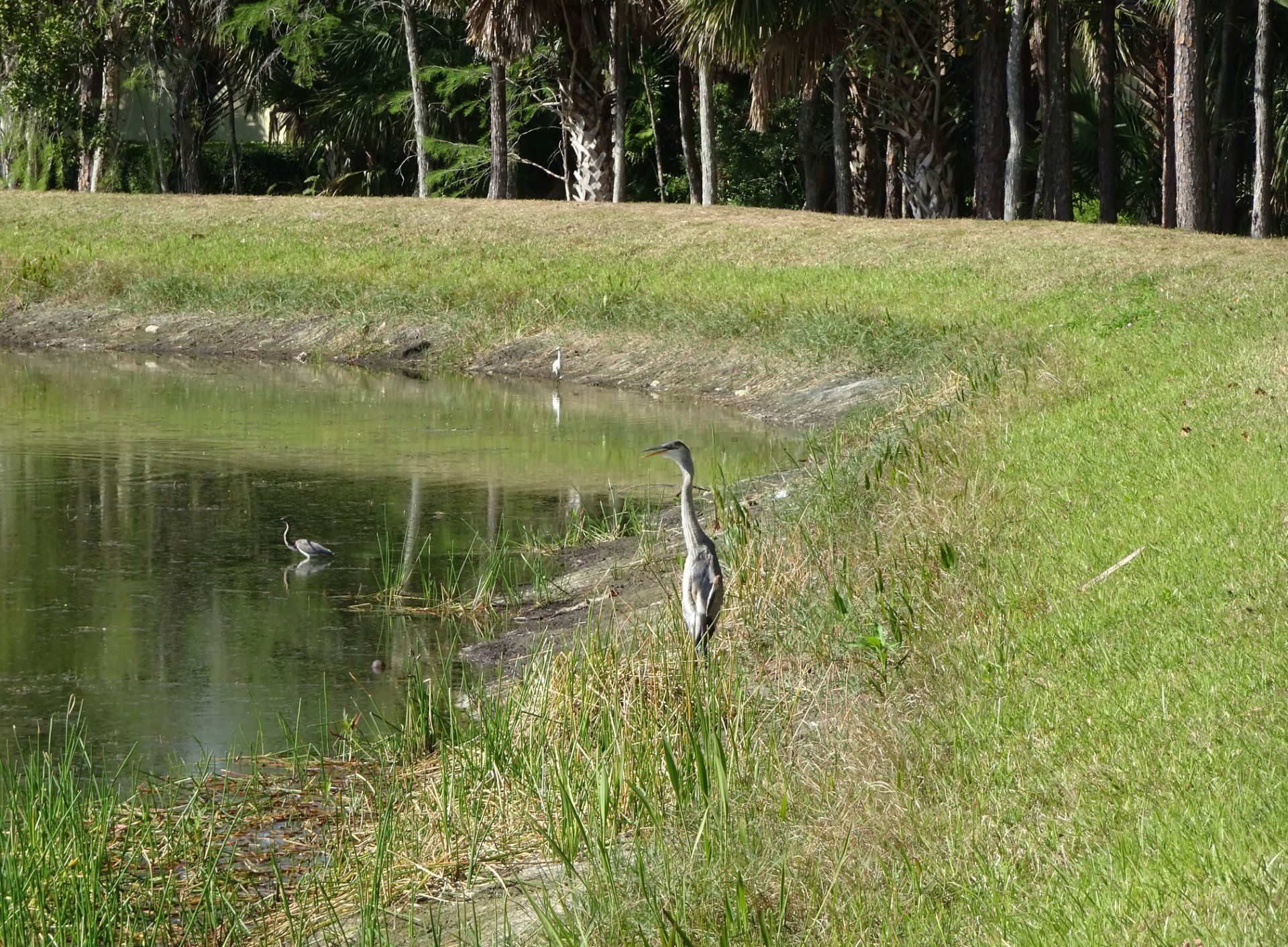
- Rare, Threatened and Endangered Species Surveys
- Biological Assessments
- Floral and Faunal Surveys
- Habitat Characterizations
- Mitigation Bank Design and Monitoring
- NEPA Compliance Documents
- Regulatory Compliance Monitoring
- Seismic Survey Monitoring
- Habitat Damage Assessment
- Water Quality Investigations

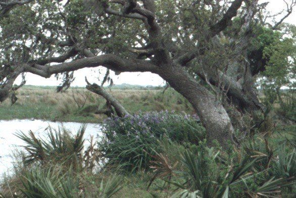
SMALL & LARGE SCALE BIOLOGICAL SURVEYS
Our firm has been instrumental in performing wetland delineations and biological surveys on large-scale projects, spanning multiple states, as well as small individual one-acre projects. CEI employees are well known amongst federal and state agencies for their biological competency.
WETLAND SERVICES
Coastal Environments, Inc. provides numerous wetland related services to assist clients in Planning and Resource Management, Regulatory Compliance, Environmental Investigations and Characterizations, and Litigation Consulting. Many of these services are in response to regulatory compliance with federal, state, and local governmental laws, regulations, and executive orders, the most commonly being the Clean Water Act of 1972, as amended and the National Environmental Policy Act (NEPA):
- Wetland Delineations/Determinations
- Threatened & Endangered Species Surveys
- Section 10/404 Permit Applications
- Alternatives Identification and Evaluation
- Compensatory Mitigation & Monitoring
- Wetland Impact Assessment
- Vegetation Type/Habitat Mapping
- Wetland Creation and Restoration Design and Implementation
- Wetland Damage Assessment
- Expert Witness Testimony

Experience and Capabilities
- Wetland delineations and permit applications for 250-ac petrochemical complex in Geismar, Louisiana.
- Wetland delineations, environmental site assessments (ESA), T&E surveys and permit applications for dozens of transmission lines and substations throughout Louisiana for Cleco since 1995.
- Over 20 10-to-800 mi-long pipeline corridor and facilities surveys for wetlands and T&E along the northern Gulf of Mexico.
- Wetland delineation, ESA and permit advisory services for a 100-ac port site in Plaquemines Parish, Louisiana.
- Wetland delineation, ESA, T&E survey, and permit application for proposed 9-mi long railroad in Ascension Parish, Louisiana.
- Wetland delineation and permit application for commercial-residential development at Belle Terre in St. John the Baptist Parish, Louisiana.
- Over 35 wetland delineations, ESA phase 1, permits, T&E surveys and biological assessments for roads, bridges, and interchanges for LA Dept. of Transportation and Development since 1979.
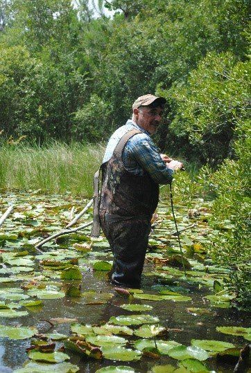
WETLAND DELINEATIONS
Coastal Environments, Inc. scientists have prepared wetland delineations ranging in size from less than one acre to over 600 acres on time and within budget. Delineations and the associated reports prepared from these investigations are as a matter of course accepted by the U.S. Army Corps of Engineers (New Orleans, Vicksburg, Galveston and Mobile Districts) and commended for their accuracy and thoroughness.
Because wetland delineations are continuously being conducted, CEI maintains an extensive collection of historic though modern maps, aerial photographs, and reference materials including: soils maps and surveys, geologic and hydrologic maps, flood zone maps, aerial photographs, National Wetland Inventory Maps (1956, 1978, 1988), land use maps, regional vegetation inventories, threatened and endangered species inventories, and topographic maps. Additional data is routinely downloaded from the Internet for specific projects and/or obtained through personal communication with government agencies.
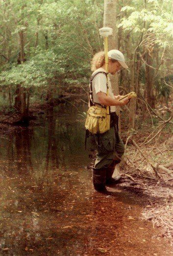
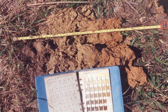
Data gleaned from in-house resources are combined with field sampling and surveying to determine the extent of wetland vegetation, wetland soils, and wetland hydrology on the project sites. A qualified biologist with expertise in delineating wetlands and training using approved U. S. Army Corps of Engineers (Corps) criteria conducts the wetland field investigations. Transects are run across the site to identify vegetative communities, soil series, and wetland hydrology. Data collected are recorded on standard data forms as required by the Corps. In addition, each sampling site is recorded, photographed, and mapped to indicate the habitat type, soil condition, and existing hydrology.
The results of the field investigation, conducted according to criteria included in the 1987 Corps of Engineers Wetlands Delineation Manual and 2010 Atlantic and Gulf Coastal Plain Regional Supplement are then documented in a succinct report. Project area maps and color photographs taken during the field investigation are incorporated into the report and depict the study area's regional setting and site location, representative wetland communities, soil types (i.e., hydric, non-hydric, hydric inclusions), topography, and extent of wetlands identified during the field inspection.

The Corps’ standard data forms are included in the report to document sample plot conditions in order to aid the Corps in their jurisdictional wetland determination of the study site. The wetland delineation map is compiled using field collected GPS data points. The project location map and wetland delineation map are prepared using computer software with hard copy maps, suitable for submittal to the Corps as part of a Section 404 Department of the Army Permit Application.
ENVIRONMENTAL PLANNING SERVICES
Coastal Environments, Inc. (CEI) has been a leader in environmental planning for over 58 years. As a pioneer in resource management, CEI advocates the use of environmental resources on a sustainable basis through comprehensive planning. The continued well-being of our communities’ economic and cultural institutions, and quality of life, depends on the land use and resource management commitments made today. To be effective, the planning process must include direct participation of all affected interests and be comprehensive in perspective by considering the full range of social, economic and environmental concerns that shape the future.
CEI uses a comprehensive, multi-disciplinary approach to planning that is based in its applied science division. This arrangement provides planners direct support by essential scientific and technical personnel including, ecologists, biologists, botanists, geographers, GIS professionals, hydrologists, geologists, archaeologists, and geomorphologists. Environmental planning services provided by CEI include: regional and local land use planning, land use regulation, regional facility siting analyses, best management practices, wetland management, wetland restoration and mitigation, environmental damage analyses, and best use site analyses. In all cases science is applied in support of planning. CEI works to balance the needs for human use of the land with the need for conservation and preservation of natural resources.
CEI’s planning team includes ten members with advanced degrees, seven have PhD’s and three have Masters’ degrees. Three team members are experienced and qualified GIS professionals. CEI’s planning team offers a unique combination of talents to effectively provide a full range of environmental planning services. The firm has extensive experience in the development of comprehensive plans for coastal and riparian cities, towns, floodplains, wetlands, nature preserves, estuaries and the regions of which they are a part. These plans are developed through the firm’s expertise on coastal and river basin forms and processes, applicable control structures, hydrological and geological sampling and analyses methodologies, and knowledge of the effects of continued development in the nation's riparian and coastal areas.
Representative Planning Experience
- Comprehensive Resource Management Plan for the Mississippi Gulf Coast
- Avery Island Comprehensive Plan
- Dauphin Island Comprehensive Plan
- Multiple-use Management in the Mississippi River Delta
- Multiple-use Management Plan for the Atchafalaya River Basin
- Coast 2050: Comprehensive Management for Wetland Preservation in coastal Louisiana
- Bayou Sauvage National Wildlife Refuge Master Plan and Environmental Impact Statement
- Revision of Wetlands Use Plan of the Mississippi Coastal Program
- Birmingham Area Bicycle, Pedestrian and Greenway Plan
- Guidelines for Management of the Pontchartrain Basin
- Birmingham Park and Recreation Master Plan
- Long-Term Protection and Management Plan for Plaquemines Parish
- Coastal Zone Management Program for Plaquemines Parish
- Coastal Zone Management Program for St. Bernard Parish
- Comprehensive Management Plan for Coastal Louisiana

Representative Client List:
- Mississippi Department of Marine Resources
- Louisiana Department of Natural Resources
- City Planning Commission, City of New Orleans
- Town of Dauphin Island, Alabama
- U.S. Environmental Protection Agency
- U.S. Army Corps of Engineers
- U.S. Fish and Wildlife Service
- Avery Island, Inc.
- Louisiana Department of Transportation and Development
- Plaquemines Parish Government, Plaquemines Parish Louisiana
- St. Bernard Parish Government, St. Bernard Parish, Louisiana
Small & Large Scale Biological Surveys
Our firm has been instrumental in performing wetland delineations and biological surveys on large-scale projects, spanning multiple states, as well as small individual one-acre projects. CEI employees are well known amongst federal and state agencies for their biological competency.