Geophysical, Underwater & Airborne Remote Sensing
We offer full Geophysical and Underwater GIS and Remote Sensing services from data collection to analysis to presentation:
Terrestrial geophysics
MAGNETIC GRADIOMETERS
Magnetic gradiometers, a type of magnetometer, are passive instruments that measure the gradient of the magnetic field strength at a point on the Earth’s surface. Archaeological features exhibit either permanent or induced types of magnetism. Permanent magnetization, also called remnant magnetism, is enhanced when hearths, perishable structures, and other features are burned. Induced magnetism, or magnetic susceptibility, is increased by the organic content of pits and middens in the presence of the magnetic field of the Earth. Because of its rapid collection speed and its response to a wide array of targets, magnetic gradiometry is an excellent archaeological prospection technique.

Magnetic Gradiometer Survey, Coahoma County, Mississippi
Ground Penetrating Radar (GPR)
GPR operates by propagating a radar pulse into the ground, which responds to certain electrical properties of the soil and subsurface targets. By recording reflections along multiple transects, the three-dimensional extent of buried targets can be determined. GPR can be used to map burials, pits, trenches, hearths, stone foundations, kilns, buried living surfaces, metal objects, voids, tunnels, and other features. GPR also has an array of applications outside archaeology. CEI offers advanced GPR processing, analysis, and visualization using the software package GPR Slice.

Electrical Resistivity
Electrical-resistivity instruments respond to archaeological features through changes in soil type, moisture, and other properties, which affect the flow of an electrical current introduced into the ground. Archaeological features that may produce resistivity contrasts include ditches, pits, shell deposits, stone architecture, compacted floors, and a variety of other features.
Electromagnetic Induction (Conductivity and Magnetic Susceptibility)
Electromagnetic induction (EMI) instruments measure the interaction of an electromagnetic field with subsurface targets. One property measured by EMI, conductivity, responds to similar features as electrical resistivity. EMI also can be used to measure magnetic susceptibility, which responds to pits, midden deposits, and other type of soil disturbance.
multiple method surveys
Each of the four geophysical techniques can delineate a range of targets that can guide future investigations, as well as serve as a primary data set that can be used to directly address archaeological questions. Together, however, these techniques are complimentary, characterize a richer set of features, and help ensure the success of the survey.

Ground penetrating Radar (GPR) Survey, Temple of The Masonry Altars (Structure B4), Altun Ha, Belize

Magnetometer and EMI Data on Contact-Period Pit Features
Underwater Remote Sensing
CEI’s Marine Archaeology Division has been involved in marine geophysical studies in a variety of environments since 1977. Many of these projects have involved intensive remote-sensing and cultural resource investigations of marine and riverine environments in Louisiana, Texas, Mississippi, Alabama, Arkansas, Florida, as well as in the waters of the Gulf of Mexico. These studies have included remote-sensing surveys, processing of geophysical datasets, and archaeological interpretation of remote-sensing data. In addition, we conduct hydrographic surveys, remote-sensing surveys designed to specifically identify underwater hazards, such as pipelines and well heads, and remote-sensing surveys to collect information on the natural environment, including seabed classification and identification of oyster reefs and sea grass beds.

Marine survey conducted onboard the Lucy G., CEI's thirty-two (32') foot Scully boat
Magnetometer
Magnetometers measure the Earth’s ambient magnetic field. Deviations from the ambient background are called anomalies, which typically are generated by the presence of ferrous objects. Each anomaly recorded by the magnetometer is measured, and the magnetic intensity, signature, and persistence of each anomaly is used to make inferences about the identity of the source object. For marine survey projects, magnetometers are used to locate metallic objects that might represent submerged cultural resources (e.g., shipwrecks or anchors), as well as hazards or impediments to planned activities (e.g., pipelines).

Magnetometer being deployed
Side-Scan Sonar
Side-scan sonar is an instrument that, through the transmission of dual fan-shaped pulses of sound and reception of reflected sound pulses, produces an acoustic image of the bottom. The side-scan sonar data are used to map bottom conditions within the project area and identify features of interest.

Side-Scan Sonar Image of Historic Wreck
Sub-Bottom Profiler
Sub-bottom profilers use low-frequency acoustic waves to collect information on subsurface features and shallow subsurface stratigraphy in the survey area. These returns are received by hydrophones in the tow fish. The data sets are computer processed and reproduced as a cross-section scaled in two-way travel time (the time taken for the pulse to travel from the source to the reflector and back to the receiver). Using estimates of the velocity of sound through the water and the seabed, this travel time can then be converted to depth in the sediment column.

Sub-Bottom Profiler 3D Volume showing stratigraphy below the seafloor
Echosounders
Echosounders are used to obtain information on bathymetry in the surveyed area. In addition, it also can be used to identify objects that extend above the seabed.
Single beam and multi-beam echosounders are sonar systems that obtain detailed information on bathymetry in the surveyed area. In addition, they can also be used to identify objects that extend above the seabed.

3D Visualization of Multi-Beam Bathymetry
AIRBORNE REMOTE SENSING
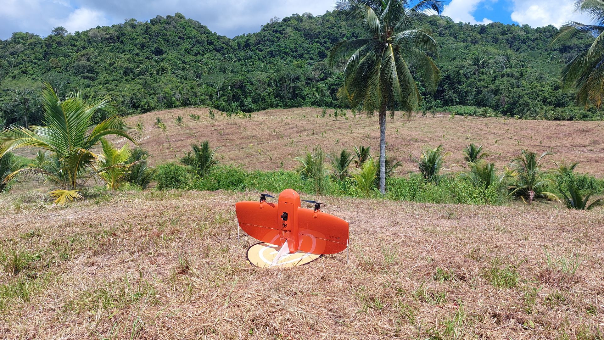
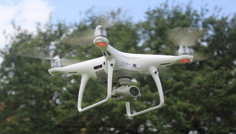
CEI utilizes airborne remote-sensing data from a variety of sources, including drone / unmanned aerial systems (UAS) platforms. Our UAS capabilities include the collection of LiDAR data, as well as both multispectral and standard RGB imagery. Our primary UAS, a fixed-wing Wingtra One Gen II, can collect high-resolution data with survey-grade spatial accuracy over vast areas. This aircraft is also Blue and Green listed with respect to the National Defense Authorization Act (NDAA), which allows it to be used on sensitive federal and state projects. We also operate quad copters manufactured by DJI, which allow the collection of high-resolution images and video.
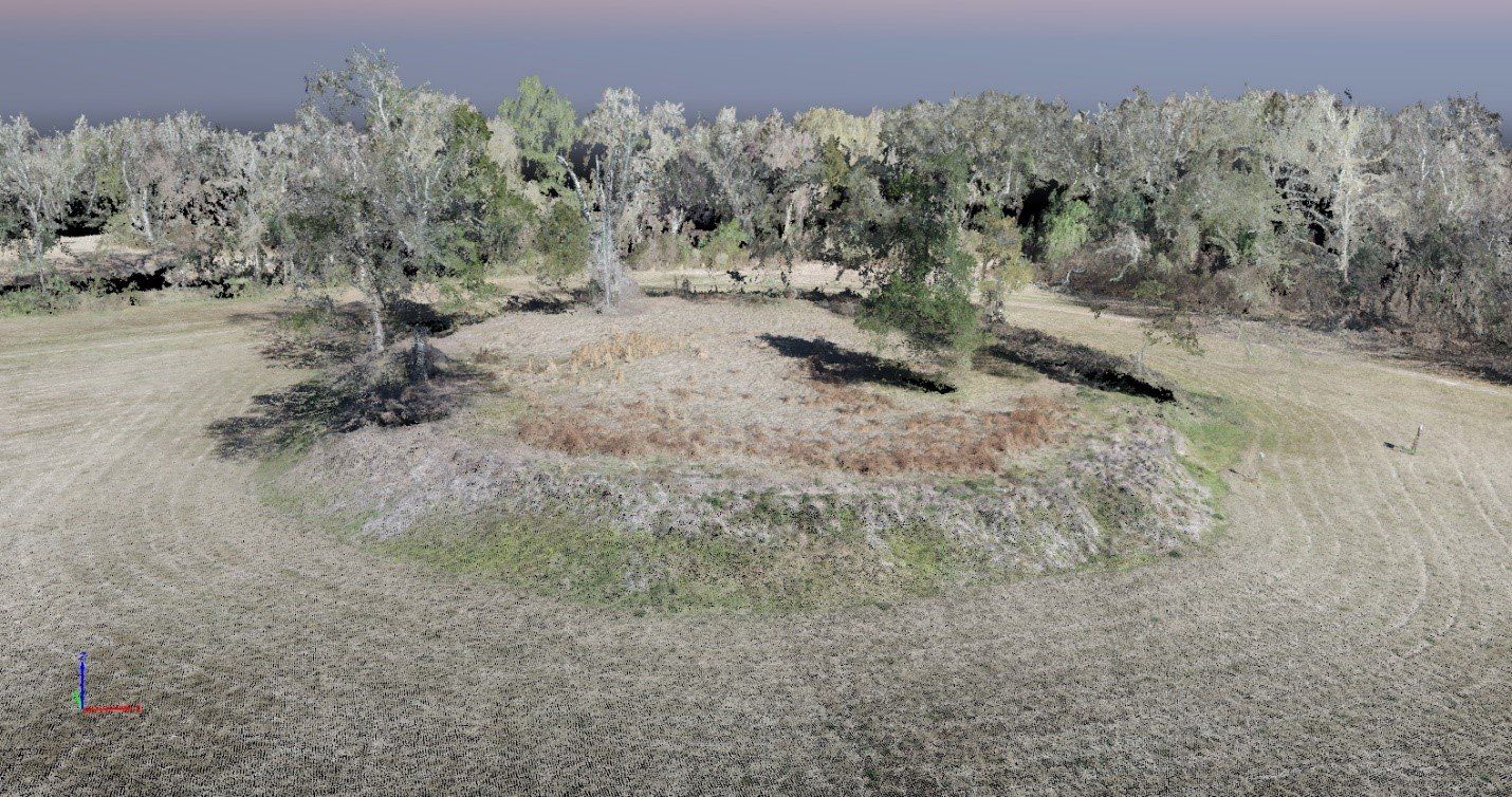
CEI’s LiDAR capabilities allow the collection of extremely high-resolution elevation data. LiDAR sensors can penetrate tree canopy, revealing archaeological features and many other types of targets. CEI staff can process and classify LiDAR data, creating bare-earth digital terrain models and other geospatial products for many applications.
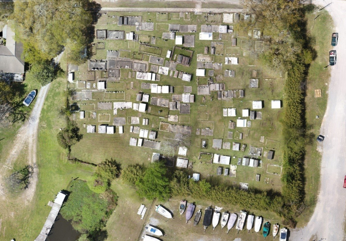
CEI also uses Pix4D software, which allows us to create a variety of high accuracy 2D and 3D spatial products from RGB and multispectral imagery that integrate seamlessly with geographic information systems (GIS). Multispectral data can yield a variety of useful information about ground cover, including the classification of plant species and measurement of vegetation health.
CEI staff includes multiple FAA Part 107 UAS pilots and all work is performed under FAA guidelines for commercial UAS operation.