
GIS
Geographic Information System (GIS)
Coastal Environments, Inc. has provided
a variety of GIS services
over the past two decades.
Our multidisciplinary GIS team is capable of research, database development, spatial analyses, imagery analyses, cartographic design, and report production.
Offering The Following:
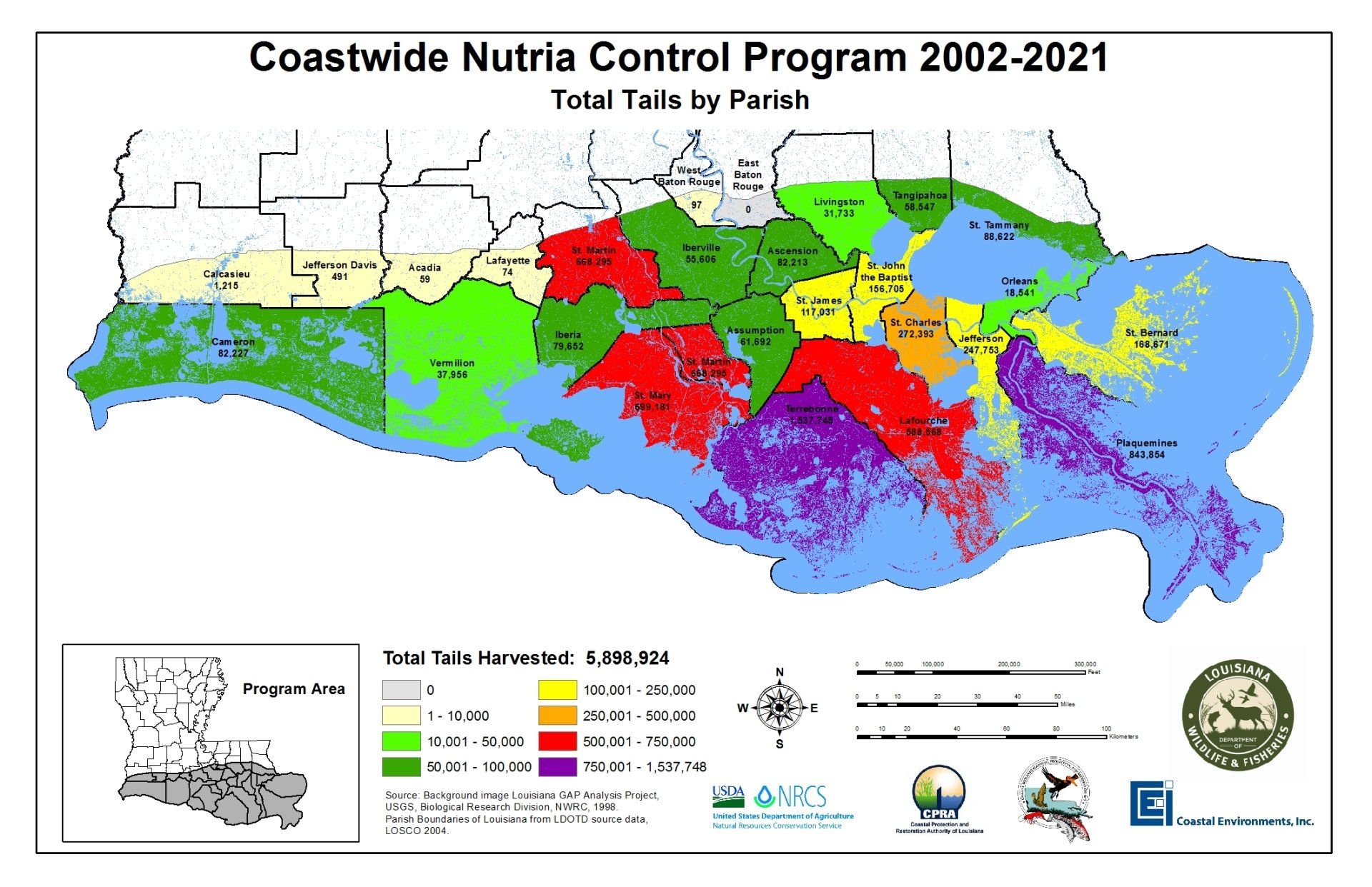
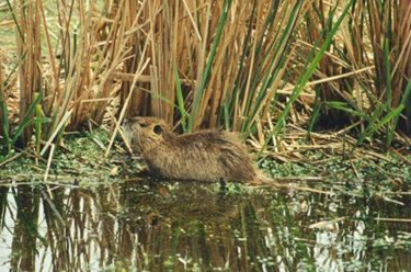
We provide tools to link databases and maps as well as visualizing and querying data in order to fit each project’s unique needs with a cost-saving dynamic that can be customized to your preference. Our GIS staff is uniquely qualified and has the equipment to collect, analyze, and present spatial information for projects in both the public and private sectors. Our multidisciplinary team has extensive knowledge involving environmental legacy litigation, land ownership dispute cases, environmental management, restoration, and planning projects. Partnering with the Louisiana Wildlife and Fisheries Department, one of our oldest projects is the Coastwide Nutria Control Program, which has been going strong for over 17 years.
GPS & Survey
Coastal Environments, Inc. offers a range of survey services, including GPS Survey and Total Station. Our pool of the latest Trimble Geo 7X units provide post-processed spatial data in the decimeter accuracy range. For centimeter-accuracy mapping needs, we operate a real time kinematic (RTK) Topcon HiPer V and Emlid Reach RS+ systems. Our survey data are fully integrated with archaeological, environmental, and other applications through GIS.
Federal Vector Data
- Topographic, Bathymetric, Hydrological, Wetland,
- Soils, Census, & Flood-plain data.
- LiDAR points, and contour lines
State-Wide Vector Data
- Cadastral, Faults, Subsidence, Transportation, Habitat,
- Land-Use/Land-Cover, Pipeline, Wells (water, oil & gas), infrastructure
- Archaeological, Geological, and Historic to Current Vegetation & Land-Loss data.
Georeferenced Raster Data:
- Historical & Current Aerial & Satellite Imagery
- Historic & Current Topographic Quadrangles
- Geologic Morphology
- Land-Loss Processes
- Historical General Land Office Survey Plats
- Historical T-Charts
- LiDAR DEM
- (Some historical references date to 1800s)
Implementing GIS technology
Our GIS staff is uniquely qualified to assist clients in both the public and private sectors to develop and implement GIS technology for the solution of a wide range of data-intensive technical problems. We have the equipment and the expertise to collect, analyze, and present spatial information to meet the needs of your project.
Learn About Our Remote Sensing Services
Browse Our Website
Business Locations
All Locations
LIST
MAP
- Corporate Office 1260 Main St, Baton Rouge, LA 70802, United States
- New Orleans, LA Office 2045 Lakeshore Dr, New Orleans, LA 70122, United States
- Houston, TX Office 1500 McGowen St, Houston, TX, 77004, United States
- Corpus Christi, TX Office 525 S Carancahua St, Corpus Christi, TX, United States
- Biloxi, MS Office 812 Water St, Biloxi, MS, United States